
NEWS
Heat dome to keep Central US sweltering throughout the week


By Alex Sosnowski, AccuWeather senior meteorologist
Published Jun. 20, 2022 12:21 PM CDT | Updated Jun. 21, 2022 2:16 PM CDT
Extreme heat will continue across the central U.S., challenging daily records and creating a high risk of heat-related illnesses.
Forecasts indicate that dangerous and record-challenging heat is expected for the remainder of the week in the south-central United States, AccuWeather meteorologists say, while parts of the Midwest can expect temperatures to ease slightly from triple-digit highs at times.
A tremendous dome of heat will continue to spin over the central U.S. this week like a giant wheel with the most persistent extreme temperatures centered over the southern Plains and lower Mississippi Valley region.
Within the core of the heat dome, temperatures will peak well into the 90s to near 100 in many places, while AccuWeather RealFeel® Temperatures will reach the 110s at times. At this level, there is a high risk of heat-related illness, and people are encouraged to avoid strenuous activity, drink plenty of fluids and seek an air-conditioned environment when possible, experts say.
The buildup of heat can make many urban areas unbearable at night without air conditioning because paved, concrete and brick surfaces give off heat absorbed throughout the day for many hours at night.

As the giant wheel of heat wobbled, a surge of 100-degree warmth shifted from the Dakotas on Sunday to Minnesota and northern Wisconsin on Monday.
Bismarck, North Dakota, hit 100 Sunday and smashed the old record of 97 set during the Depression Era in 1933. Fargo, North Dakota, tied its record of 101 Sunday, which was also set in 1933.
Temperatures hit 101 in Minneapolis Monday, breaking the old record of 98 from 1933 and hitting triple digits for the first time since 2018. With extreme heat in the forecast, the Minnesota Department of Transportation took to social media in recent days to warn motorists about the possibility of roads buckling under the harsh conditions.
International Falls, Minnesota, a place with a reputation as the icebox of the nation, was hotter than Miami, located 1,700 miles to the southeast, on Sunday and Monday. The high on Sunday in International Falls was 93 degrees, compared to 92 in Miami. On Monday, highs in the two cities were 92 and 89 degrees respectively.
The second dangerous surge of heat in as many weeks will shift as the week progresses with the worst levels of both heat and humidity forecast for Tuesday into Wednesday in the Midwest, according to AccuWeather Senior Meteorologist Dean DeVore. This comes after much of the region had some relief from the extreme heat with high temperatures in the 80s and lower humidity over the past weekend.

This image shows actual temperatures (F) as of 2 p.m. CDT, Tuesday, June 21, 2022.
On Tuesday, the extreme heat, which could produce temperatures in the upper 90s and low 100s, will rotate southeastward into much of Wisconsin, Illinois, Michigan, Indiana, Iowa and Missouri. At Chicago’s O’Hare Airport, the record of 101 set during the blistering summer of 1988 will be challenged. That summer ranks as one of the hottest on record for much of the central U.S.
Tuesday’s record in Green Bay, Wisconsin, was also set in 1988 and will be challenged. It will be a similar story for St. Louis, where the record high of 99, also established in 1988, could be topped.
The excessive heat will continue to migrate southeastward at midweek. On Wednesday, temperatures in Nashville could rival the record high of 100 set in 1988. A bit farther to the east in Charlotte, North Carolina, the daily record of 100 Wednesday was set more recently in 2015. In Atlanta, the record high of 98 set in 1964 will be challenged.

As the bubble of extreme heat moves off to the southeast, temperatures will throttle back a bit with the aid of showers and thunderstorms in parts of the Midwest as the week progresses.
In Minneapolis, high temperatures will trend down to the upper 80s Tuesday and the mid-80s Wednesday. After Tuesday’s extreme heat, afternoon temperatures are forecast to hover in the mid-80s to near 90 in Chicago for the balance of the week.
Meanwhile, over much of the south-central region, little change in day-to-day temperature is anticipated through the weekend, which will keep the demand for energy high, forecasters say.
Many daily record highs over the South Central states will be just a bit out of reach in the pattern, with established records in most locations in the low 100s. However, high temperatures will still range from 5-15 degrees above average for the week.
Typical highs generally range from the low to middle 90s and will end up being within a few degrees of 100 each day in cities such as Dallas; Oklahoma City; Little Rock, Arkansas; and Shreveport, Louisiana.
The same bubble of intense heat is likely to rotate southwestward into the Mississippi Delta region toward the end of the week, and that could be enough to rival record highs. Even Gulf Coast cities such as New Orleans could record a 5- to 10-degree spike in high temperatures. The record highs of 101 set in 2009 and 97 set in 2016 could be challenged Friday and Saturday.

One-hundred-degree highs are forecast for Houston starting on Thursday and lasting through at least Sunday.
Another bubble of extreme may return to parts of the Plains and Midwest toward the end of the week.
“While temperatures and humidity levels ease a bit for the end of the week in parts of the Midwest, more dangerous temperatures and humidity will return by the upcoming weekend,” DeVore said.
Temperatures in St. Louis Saturday are forecast to rival if not break the record of 102 set in 1954. Similarly, temperatures could spike near the century mark in Nashville and make a run at the record of 100 set in 1988 on the same day.
A more substantial temperature decline may progress from late in the weekend to early next week over parts of the northern Plains and Upper Midwest, where highs may retreat to near average for a few days. However, no relief is in sight for much of the South Central states; most cool air and storms will be forced well to the west, north and east of the region.
For many portions of the northern and central Plains and Midwest so far this summer, there has been enough fluctuation in the heat to avoid long strings of days with record highs. The summers of 1953 and 1988 were brutal in this respect. There were many days in a row on which record highs were set and many of those temperature marks remain in the record books to this day.
For example, in downtown Kansas City, Missouri, the 11-day period from June 9 to June 19 saw seven record highs set in 1953. In 1988, record highs were broken every day from June 20 through 25 in Kansas City. Record highs set during the period from June 9 to June 25 range from 97 to 104 degrees in the city.
Members of the Bowie City Council will meet at 6 p.m. on Aug. 25 to finalize the budget and conduct a public hearing on a proposed tax rate.
The ordinances adopting both the 2026-27 budget and the 2026 tax rate are on the agenda for action. The public hearing on the tax rate presents a rate of .5750 cents per $100 in property value, which is slightly higher than the 2025 rate that is .5430.
The new rate is projected to generate $2,990,998, compared to $2,703,176 from last year’s rate. This is the first significant change in the rate since 2019, when it was .5445 cents. The next year it went to .5447 cents, where it stayed until 2023, when it went to .5430 cents, through 2025.
A bid will be awarded for the Rock and Pillar Street drainage project. Wall Contractors will be recommended by the city engineer and staff review. The bid came in about $1.3 million, which was lower than the estimated $2 million. It is expected to straighten the channel and get this intersection reopened for traffic after more than a year of closure to collapse of a portion of the pavement on the street.
The council will consider stop signs regulating traffic flow around the Kingdom Ridge Subdivision next to the elementary school.
In the city manager’s report Bert Cunningham will provide information on the hazard mitigation plan, the 2025-26 audit preparation and the bid for the Rock and Pillar project.

Montague County Commissioners will adopt a budget and tax rate when they meet at on Aug. 24 in the courthouse annex.
The budget hearing will be at 8:30 a.m. Aug. 24, followed by a public hearing for the proposed tax rate at 8:45 a.m.
During the regular meeting at 9 a.m., there will be one final budget workshop for any last minute tweaks or changes, followed by adoption of the 2026-27 budget and 2026 tax rate.
The proposed tax rate is .4961 cents per $100 in property value, which is the same rate as 2025. Due to the increase in property values despite the same rate, the total tax levy on all properties will see a 3.64% increase.
A copy of the proposed budget is available on the county website at https://www.co.montague.tx.us/.
Several other financial related items are on the agenda. Accumulated comp time in the sheriff office and jail will be discussed. The commissioners also will consider any year-end expenditures utilizing any or the budget year contingency funds.
Other items on the agenda will include: Acceptance of the District Attorney’s 2023- 2024 and 2025 Chapter 59 asset forfeiture reports and authorize DA Katie Boggeman to sign them; imposition of optional fees from the Texas Department of Motor Vehicles for 2027; House Bill 3834 cybersecurity and AI training certification for state and local governments compliance reports; interlocal cooperation agreement between the Department of Public Safety and the county court and district court; review the sherif office application for sheriff immigration law enforcement grant program Senate Bill 8; consider distribution of state grant HB 3000; and consider using Real Estate Station LLC Agent Denise Thurman to sell 5.9 acres on the corner of U.S. 81 and State Highway 59.
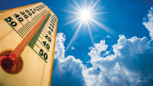
It should be no surprise, the month of July is recorded as the hottest month on record for the country.
July wrapped up with seven straight days of 100 degrees or higher July 25-31. August also opened hot with the first 100-plus degree day on Aug. 3 and it has topped that marked through Aug. 19. On Tuesday the high was 107 degrees at the water plant, but in town thermometers recorded 108 and 109 degrees.It was expected to top that mark on Wednesday.
There was no rainfall recorded in July or in August. Bowie has only 21.71 inches for the year so far and Nocona has 22.35 inches.
Lake Amon Carter
Aug. 19 –
917.22 msl, 80.2% full
July 19 – 918.10 msl, 86.1%
Aug. 19, 2025 – 919.84 msl, 98.8% full
Lake is full at 920msl
Lake Nocona
Aug. 19 – 823.48 msl, 76.3% full
July 19 – 824.41 msl, 81.05%
Aug. 19, 2025 – 826.878 msl, 95.85%
Lake full at 827.5msl






-

 NEWS3 years ago
Suspect indicted, jailed in Tia Hutson murder
-
 NEWS4 years ago
2 hurt, 1 jailed after shooting incident north of Nocona
-
 NEWS3 years ago
SO investigating possible murder/suicide
-

 NEWS4 years ago
Wreck takes the life of BHS teen, 16
-

 NEWS3 years ago
Murder unsolved – 1 year later Tia Hutson’s family angry, frustrated with no arrest
-
 Show us something good9 years ago
Country music star children perform in Bowie
-
 100th Birthday4 years ago
Looking back at the 1958 Centennial edition of The Bowie News
-
NEWS3 years ago
Sheriff’s office called out to infant’s death