
NEWS
Forest service plans controlled burning operations


The National Forests and Grasslands in Texas will conduct controlled burning operations across its landscape in the next few months.
Controlled burns are carefully planned, prepared, and conducted by qualified personnel who consider available support resources, seasonality, vegetation condition, and weather forecasts before ignition in any burn area. Smoke columns may be visible on the burn days, and some areas of the forests and access roads may be closed to provide for firefighter and public safety. All controlled burns are coordinated with associated counties complying with any applicable local burn bans.
The controlled burn areas may be marked with signs, including signboards and electronic road signs. Those near national forests may see drift smoke or smoke columns, reduced visibility in low-lying areas, and additional fire vehicle traffic along roadways. If drivers encounter smoke on the road, they should reduce their speed and use low-beam lights to become more visible to other traffic.
“The public may see a helicopter or UAS (unmanned aerial system) aircraft overhead, smoke columns rising, and smoke settling in low-lying areas at night,” said National Forests and Grasslands in Texas Fire Management Officer Jamie Sowell.
This year, a new online prescribed fire (controlled burn) mapping tool is available to track proposed, active, and completed burns. The new map tool is located at Southern Region Prescribed Burn Accomplishment Tracker (arcgis.com)
“We will continue to post our controlled burns on our website the morning of the burn, and the online mapping tool will provide updated information on the status of burns on National Forest lands.” Said, Sowell. “Additionally, the NFGT Facebook page is updated the morning of any controlled burn activity.”
Controlled burning dramatically reduces the chances of a wildfire spreading out of control. Therefore, controlled burning protects subdivisions, businesses, and transportation corridors from potential wildfires. In addition, controlled burning is accomplished in a matter that uses low-intensity fire to “clean out” the undergrowth that can hinder the food supply for wildlife and livestock and reduce fuel loadings to mitigate the potential for disastrous wildfires.
Burning underbrush promotes new growth of tender vegetation beneficial to wildlife such as birds,
deer, and turkeys. In addition, prescribed burns benefit wildlife habitat by removing dead and dying vegetation from the understory, which improves the availability of forage and the quality of browse for wildlife. Reducing the underbrush also improves brood and nesting habitat for turkey, quail, deer, and other wildlife species.
The Forest Service only burns when environmental conditions are most favorable based on weather forecasts from the National Weather Service and within the direction and policy set forth.
For individuals with respiratory and other health concerns, we recommend closing windows and ventilating their homes by using the air conditioning or heating system. Some may want to leave the area until the smoke clears. We encourage anyone sensitive to smoke to contact the local Ranger’s District Office to provide contact information so we can notify you on the day of planned burns in your area.
For more information, visit our website and follow the fire information feature. www.fs.usda.gov/texas.

Members of the Bowie City Council will face a brief agenda when they meet at 6 p.m. on Oct. 13 in the council chambers.
Following routine reports and consent agenda items, the council will consider a resolution authorizing submission of the city’s 2027/2028 Texas Community Development Block Grant application to the Texas Department of Agriculture.
Then council members will consider approving Bob Blackburn for appointment as a reserve police officer with the Bowie Police Department.
Following an executive session, the council will discuss and potentially take action regarding the annual employment evaluations and duties of both the City Secretary and the Municipal Court Judge.

After nearly three months of no rain, Mother Nature brought the showers this past week.
Downtown Bowie rain reports varied from 7 to 8 inches, while the Saint Jo area reported a 10-inch total. The city water plant in Bowie reported 5.55 inches on Sept. 30 with 1.6 Oct. 1-3.
Nocona saw a total of 6.31 inches of rain across Sept. 26 to Oct. 3.
On Oct. 6, Lake Amon G. Carter saw a level of 917.39 mean sea level rising to 81.31% full. Just one week earlier the lake was 73.6% full, while one year ago it was 94.01%. The lake is full at 920msl.
Lake Nocona was 73.7% full at 823.02 on Oct 6. One week earlier it was 70.41% full and one year ago it was 92.41%. The lake is full at 827.5 msl.

By BARBARA GREEN
editor@bowienewsonline.com
One Montague County City has joined the battle against any data centers being built in this county and there is a petition drive underway to urge the commissioner’s court to keep data centers out of Montague County.
At a Sept. 28 called meeting of the Saint Jo City Council, officials unanimously approved a resolution stating its opposition to the “siting, permitting, construction or operation of data centers and similar hyperscale computing facilities within the city limits or the city’s extraterritorial jurisdiction.”
City Secretary Debbie Dennis said several citizens approached Councilor Jack Dunn about their data center concerns and he helped prepare a resolution. The council gave unanimous support.
Read the full story in your Thursday Bowie News.






-

 NEWS3 years ago
Suspect indicted, jailed in Tia Hutson murder
-
 NEWS4 years ago
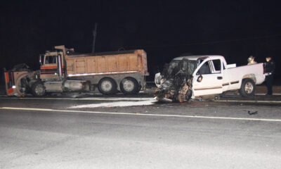
Wreck takes the life of BHS teen, 16
-
 NEWS4 years ago
2 hurt, 1 jailed after shooting incident north of Nocona
-

 NEWS3 years ago
Murder unsolved – 1 year later Tia Hutson’s family angry, frustrated with no arrest
-
 NEWS3 years ago
SO investigating possible murder/suicide
-
 Show us something good9 years ago
Country music star children perform in Bowie
-
 100th Birthday4 years ago
Looking back at the 1958 Centennial edition of The Bowie News
-
NEWS3 years ago
Sheriff’s office called out to infant’s death