
COUNTY LIFE
Double-whammy storm covers central U.S. bringing possible winter weather
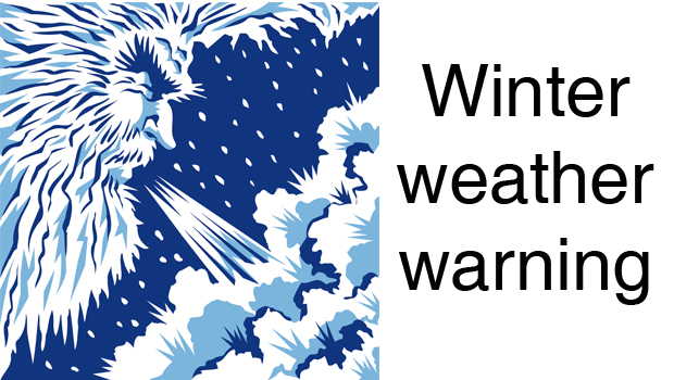
A two-part storm is set to deliver back-to-back hits of wintry messes to the central United States this week, seeing 2020 to the door with slippery roads and hazardous conditions.
As the first part of the double-barreled storm with snow and ice spreads its wintry mix and travel disruptions across the north-central U.S. into midweek, forecasters are warning of a new round of snow and ice. The second round is expected to unfold over Texas before spreading northward and hitting some areas of the Plains and Upper Midwest with another dose of freezing and frozen precipitation prior to the end of the week. https://playlist.megaphone.fm/?e=ADL5474698738
A swath of heavy snow and ice from the first part of the storm will continue to advance northeastward from Kansas, Missouri, Nebraska and Iowa into Tuesday afternoon before taking aim at northern Illinois, Minnesota, Wisconsin and Michigan during Tuesday night and early Wednesday.

This radar image was captured around noon CST, Tuesday, Dec. 29, 2020. Snow is visible as blue, Ice is depicted as shades of purple and pink and rain is shown in green, yellow and orange. (AccuWeather)
The snowy part of the storm has made for dangerous travel conditions in parts of Colorado.
Interstate 76 in the northeastern part of the state was closed in both directions due to adverse weather during early Tuesday morning, according to the Colorado Department of Transportation.
Farther east, an icy and slippery commute affected motorists around Kansas City, Missouri, into Tuesday afternoon, but it is snow that is forecast to pile up with enough to shovel and plow around Omaha, Nebraska; Des Moines, Iowa; and Sioux Falls, South Dakota into the evening hours.

A period of snow is forecast to swing across Chicago and Milwaukee during Tuesday evening and may catch some people on their way home from work or school. The same burst of snow will move across the Detroit area, but it will not be until the late evening or overnight hours Tuesday. During the morning drive on Wednesday, snow will change to a brief period of ice around the Motor City, which can make for an especially dicey commute.
CLICK HERE FOR THE FREE ACCUWEATHER APP
After depositing 6-12 inches of snow with locally higher amounts on Colorado, the strip of heavy snow from the first part of the storm is expected to set up over northeastern Nebraska and northern Iowa and extend to southern Wisconsin. An AccuWeather StormMax™ of 20 inches is forecast for the first part of this storm.

“A more dangerous component of the storm will be a glaze of ice that has the potential to accrue to thicknesses that can not only weigh down trees limbs, but also lead to power outages from northern Kansas to northern Missouri, southeastern Iowa and part of western Illinois,” According to AccuWeather Senior Storm Warning Meteorologist Eddie Walker.
“In this zone that extends from the central Plains to part of the Mississippi Valley, between 0.25 and 0.50 of an inch of ice is expected to build up with an AccuWeather Local StormMax of 0.75 of an inch,” Walker said.
Typically, storms of this nature produce a single dose of snow and ice, and move on. However, that won’t be the case this time, as the encore of the storm will bring another messy mix.
Another disturbance in the jet stream is forecast to roll in from the Southwestern states as moisture lingers over the South Central region of the nation, triggering a new round of snow, ice and rain that will blossom over Texas Wednesday and roll northward spanning Wednesday night, Thursday and Friday over the Plains, Mississippi Valley and Midwest.

The second round of snow is forecast to begin much farther south than the first with portions of northern Mexico and southwestern Texas to experience a significant accumulation.
“Places such as San Angelo, Texas, only pick up 2-3 inches of snow per year, on average, but this storm can deliver that amount all in one shot,” Walker said.

Abilene, Texas, is another city that may receive close to its seasonal average for snowfall with this single storm. A close call between some snow and ice is forecast for Oklahoma City during Thursday night, after the first part of the storm brings rain and thunderstorms into Tuesday night.
Farther north, the swath of snow and ice is expected to overlap areas that have been or will be hit by wintry precipitation from the first part of the storm.
Most areas from the lower Great Lakes to the Ohio and lower Mississippi Valley will remain on the warm side of both parts of the storm with rounds of rain in store. However, there is expected to be a period of ice that can glaze roads and sidewalks for a second time in 48 hours.

The Ray Walker Memorial VFW Post #8558 will host a Memorial Day service at 11 a.m. on May 26, 100 Baylor Street in Nocona.
The public is invited to attend to celebrate this special holiday to remember those who were killed in service.
Later in the day attend the fundraiser barbecue rib dinner at the Nocona Senior Citizen’s Center. Cost is $10 for adults and $5 for children. Enjoy ribs, french fries, beans, cole slaw, dessert and iced tea. Proceeds benefit the center and the Meals on Wheels program of Nocona.
Veterans eat free. Meal prepared by the award winning Nocona High School barbecue team.

Five Montague County high schools will graduate in ceremonies May 23 and May 24.
Make sure to see the 2025 Graduation Keepsake Section in the May 22 edition of The Bowie News. It is the only one to feature seniors from all seven of the area schools including Bowie, Bellevue, Gold-Burg, Forestburg, Nocona, Prairie Valley and Saint Jo.
Bowie High School
The Jackrabbits walk the stage at 8 p.m. on May 23 in Jackrabbit Stadium. Teacher Tabitha Jones was selected by the students to be the speaker.
Seniors Virginia Watson and Boston Farris will pass the mantle of leadership to the junior class represented by Laney Enlow and Hayden Heugatter. Superintendent Blake Enlow will present diplomas.
Read the full story in the Thursday Bowie News.
All members of the Tales ‘N’ Trails Museum or those interested in learning more about Montague County’s largest museum are invited to attend the annual membership meeting at 2 p.m. on May 31.
There will be a short business meeting to elect new directors afterwhich Dr. Sergio Ayala will discuss the museum’s newest archaeological exhibit. He also will conduct, “What’s Your Point?” where guests are invited to bring in artifacts for Dr. Ayala to examine.
All membership are due in May and there are several levels from which to chose starting at $35 a year. TNT is supported by its members along with donations, fundraising and grants. The museum celebrates its 15th years showcasing Montague County’s unique history.
The museum is located at 1522 E. U.S. Highway 82 in Nocona. Call 825-5330 with questions.


-
 NEWS3 years ago
2 hurt, 1 jailed after shooting incident north of Nocona
-

 NEWS2 years ago
Suspect indicted, jailed in Tia Hutson murder
-
 NEWS2 years ago
SO investigating possible murder/suicide
-

 NEWS2 years ago
Wreck takes the life of BHS teen, 16
-

 NEWS2 years ago
Murder unsolved – 1 year later Tia Hutson’s family angry, frustrated with no arrest
-
NEWS2 years ago
Sheriff’s office called out to infant’s death
-
 NEWS2 years ago
Bowie Police face three-hour standoff after possible domestic fight
-
NEWS2 years ago
Driver stopped by a man running into the street, robbed at knifepoint