
COUNTY LIFE
Stormy weather expected Friday and Saturday in the south

Americans across the southern United States are next in line for the threat of another outbreak of damaging storms heading into the weekend. AccuWeather meteorologists warn that people living in states from Texas to Georgia could be at risk for severe weather from late Friday night through Saturday night as a storm system progresses eastward.
Seven preliminary tornadoes were reported with the storms that erupted on Wednesday and Wednesday night, four of which occurred in Louisiana and caused damage to homes, according to the National Weather Service Storm Prediction Center (SPC). Dozens of incidents of damaging wind gusts, along with a few incidents of hail, stretched from eastern Texas northward to southern Wisconsin.
On the southwestern side of Cedar Rapids, Iowa, a tornado caused damage to homes and at least one injury. According to the NWS, the tornado was given a preliminary rating of EF0 and had wind speeds as high as 85 mph.
An EF0 tornado with maximum winds of 75 mph touched down briefly in Hancock County, Mississippi, moving northeastward and creating a .7 mile-long path with a width of 50 yards.
Remnants of the storms from Wednesday night pushed through the Interstate 10 and 20 corridors of Louisiana, Mississippi, Alabama, and the Florida Panhandle on Thursday morning.
As storms rolled through the New Orleans area early Thursday, a tornado warning was issued due to some indication of rotation on radar. While no tornado was confirmed, storms dumped between 2.40 and 2.70 inches of rain on the Big Easy in four hours.

By Thursday night, storms with big hail erupted over portions of central and eastern Texas, causing significant damage to vehicles. Hail as large as baseballs was reported in College Station.
Many of these same areas will be in the crosshairs of a new round of severe weather for the end of the week.

Areas extending from the southern Appalachians to the central Gulf coast are at risk for severe weather, according to AccuWeather Senior Storm Warning Meteorologist Eddie Walker.
The main threats from these storms in addition to flooding downpours are likely to be damaging wind gusts and hail.
The storms are expected to erupt near the edge of a zone of very warm air that could lead to some daily record highs being challenged in Texas on Friday. Temperatures are projected to climb into the 80s and 90s F over a broad area of Texas. A few locations, such as San Antonio, may come within a few degrees of 100 F.
“There is the potential for a derecho event during Friday night from parts of northeastern Texas and eastern Oklahoma to portions of Louisiana and Arkansas,” AccuWeather Lead Storm-Warning Meteorologist William Clark said. Should a derecho unfold, its path may eventually take it through Mississippi and Alabama early Saturday morning.
A derecho is a swift-moving complex of thunderstorms that produces extensive wind damage over hundreds of miles.
“With a fresh influx of Gulf of Mexico moisture in the form of humid air, combined with wind energy at the middle layer of the atmosphere associated with the approaching disturbance, the ingredients are there for severe weather from late Friday through Saturday,” AccuWeather Senior On-Air Meteorologist Justin Povick said. https://playlist.megaphone.fm/?e=ADL4348958722
The coverage and intensity of severe weather may hinge on the amount of sunshine available.
“Part of the atmospheric environment on Friday and Saturday may be strewn with clouds that limit daytime heating in part of the area at risk for severe weather, but where the sun breaks out, tall storms can erupt and pack a punch,” AccuWeather Chief On-Air Meteorologist Bernie Rayno said.
The Texas A&M AgriLife Extension Service in Montague County is inviting livestock producers, landowners and wildlife managers to participate in an upcoming online educational meeting focused on the New World screwworm, a parasitic pest that can have serious impacts on livestock and wildlife health.
The virtual meeting will be at 9 a.m. on June 23, via Microsoft Teams. Organizers say the session is designed to provide timely information about the biology of the pest, prevention strategies and best management practices for producers in the region.
The New World screwworm is known for its destructive larvae, which infests open wounds of warm-blooded animals. Left untreated, infestations can cause severe tissue damage and even death. Although the pest had been eradicated from the United States in the past and has now entered into Texas. Continued awareness and preparedness remain important for early detection and rapid response efforts.
“This program is intended to help producers and land managers better understand the threat and what steps to take if cases are suspected,” said Justin Hansard, from the Extension Service.
The meeting will cover several key topics, including, how the New World screwworm spreads; general livestock management practices; wildlife monitoring and surveillance considerations, participants will also have the opportunity to learn practical strategies for maintaining herd health.
How to Join the Meeting
The session will be conducted entirely online using Microsoft Teams, and participants can join in one of two ways by joining the directed link (recommended) or by copying and pasting the following link into a web browser and follow the prompts:
https://teams.microsoft.com/meet/275071149431328?p=mOH2bhAqSVgo3AgtMK
Join using Meeting ID and Passcode:
- Meeting ID: 275 071 149 431 328
- Passcode: u84hq3qX
Participants may join from a computer, tablet or smartphone. No Microsoft Teams account is required; users can select the option to join through a web browser. Attendees are encouraged to log in a few minutes early to ensure their device audio and video are working properly.
More information and fact sheets, can be obtained at our Texas A&M Agrilife Extension website: https://agrilifeextension.tamu.edu/new-world-screwworm.
The program is hosted by the Texas A&M AgriLife Extension Service, which continues to provide research-based education and outreach to agricultural communities across Texas.

The Amon Carter Lake Water Supply Corporation will meet at 6 p.m. on June 23 at the office located at 607A Lindsey in Bowie.
Public comments and consent agenda open the meeting.
Discussions will include: Review of member notification of rate increase postcards and PUC letter regarding the increase; president’s report on employee unsigned contracts of employment; review of all expenses and update of scanners for meter reading, office systems and software.
An executive session is slated for a discussion of employees, followed by a return to open session for any action.
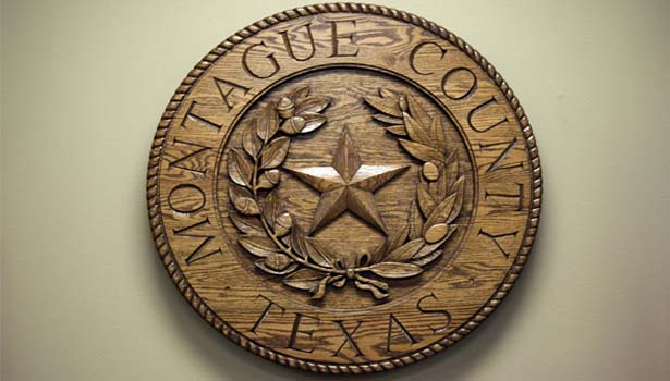
The Montague County Commissioner’s Court will meet at 9 a.m. on June 22.
The agenda includes: Montague County Historical Commission to receive a distinguished service award; discuss returning unused funds to the state from the county attorney, district attorney and sheriff’s office; open sealed bids for base rock and budget workshop.


-

 NEWS3 years ago
Suspect indicted, jailed in Tia Hutson murder
-
 NEWS4 years ago
2 hurt, 1 jailed after shooting incident north of Nocona
-
 NEWS3 years ago
SO investigating possible murder/suicide
-

 NEWS3 years ago
Wreck takes the life of BHS teen, 16
-

 NEWS3 years ago
Murder unsolved – 1 year later Tia Hutson’s family angry, frustrated with no arrest
-
 Show us something good9 years ago
Country music star children perform in Bowie
-
NEWS3 years ago
Sheriff’s office called out to infant’s death
-
 100th Birthday4 years ago
Looking back at the 1958 Centennial edition of The Bowie News