
NEWS
Next big storm to target central U.S. with variety of hazards
By Renee Duff, AccuWeather meteorologist
Updated jan. 13, 2020 11:08 AM
A winter storm brought strong winds to this lakeshore in Chicago, Illinois, on Jan. 11. Wind gusts of 50 mph fueled waves as high as 23 feet as they slammed ashore.
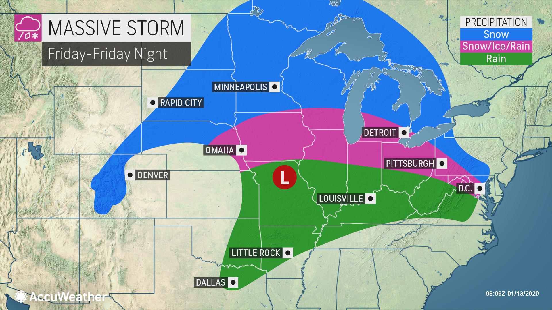
Forecasters are monitoring what they say will be the next multifaceted storm to target the central United States at the end of the week. The storm is expected to bring a variety of hazards to travelers as precipitation will vary from rain to ice to snow amid the midsection of the nation.
Prior to late week, motorists will also need to be wary of several quick-hitting snow events that will sweep through the Midwest.

The late-week storm will first bring accumulating snowfall to places such as Seattle and Portland, Oregon, as well as some rain and snow to California Wednesday into Thursday, before it reaches the Central states on Friday.
Slippery travel conditions to threaten northern Plains to Great Lakes, Ohio Valley
A fresh wave of bitterly cold air will arrive in the North Central states on Thursday ahead of the storm, which will lay the groundwork for a large corridor to face wintry weather and slippery travel once precipitation arrives.
“At this time, we expect many of the major metro areas of the Midwest to face messy commutes both Friday morning and evening,” AccuWeather Meteorologist Mary Gilbert said.
Large stretches of interstates 29, 35, 80, 90 and 94 are expected to lie within a broad area of snow and ice, making for difficult travel conditions.

In some parts of the central Plains, Ohio Valley and Great Lakes, the onset of the storm may feature all snow before a changeover to ice occurs. Where precipitation remains all snow, amounts could easily surpass half a foot.
Enough snow to shovel, plow and disrupt daily routines is possible in Fargo, North Dakota; Minneapolis and Duluth, Minnesota; Green Bay, Wisconsin; and Marquette and Traverse City, Michigan.
Increasing wind with the snow could lead to reduced visibility and localized blizzard conditions as the storm strengthens, according to AccuWeather Senior Meteorologist Matt Rinde.
Slightly farther south – where a layer of warmer air will flow in a few thousand feet above the ground – precipitation can be icy with sleet and freezing rain possible.
“Icing will be a major concern with this storm and untreated surfaces will become treacherous,” Rinde said.
At this juncture, a corridor from eastern Nebraska through portions of Iowa, Illinois, Indiana, Ohio and southern Michigan could see icy conditions. How quickly cold air is rooted out of Kansas City and St. Louis, Missouri, will determine whether icy conditions develop in these metro areas or precipitation arrives in the form of plain rain.
The Friday evening commute in Chicago could be a wintry mess with a chance for snow and ice, depending on the exact track and speed of the storm.
“Bitter cold to follow the storm will cause any areas of snow and slush to freeze,” Rinde said.
As the exact path of the storm becomes clearer in the coming days, the corridor of heaviest snow and ice may shift to the north and west or south and east. AccuWeather will continue to provide these details as they unfold.
Rain, thunderstorms may once again elevate flood concerns in southern Plains
The late-week storm will feature all rain for places such as Dallas, Oklahoma City and Little Rock, Arkansas, cities that were pounded by deadly severe weather last week.
AccuWeather meteorologists cannot rule out the potential for some severe thunderstorms to rumble through this corridor from Friday into Friday night, but a repeat of last week’s outbreak is not expected.
The biggest concern may come in the form of downpours that can reduce visibility for motorists and trigger flash flooding.
Forecasters will be closely monitoring the storm as it shifts into the Northeast by the weekend, with snow, ice, rain and gusty winds all possibilities.
Keep checking back on AccuWeather.com and stay tuned to the AccuWeather Network on DirecTV, Frontier and Verizon Fios.
By BARBARA GREEN
editor@bowienewsonline.com
Montague County Commissioner’s Court reluctantly returned money to the state connected to Senate Bill 22 in fiscal 2024.
During Monday’s regular session, County Auditor Charley Lanier explained the three transactions. SB 22 provided funding for prosecutor offices to assist with paying staff, and in the sheriff’s office for staff and equipment.
If all the money was not spent it had to be returned. Lanier explained the fund was approved in 2024, but it arrived after the fiscal year began and commissioners did not want to spend any of until the funds actually arrived in county coffers.
Read the full story in the Thursday Bowie News.

The Saint Jo City Council had a brief meeting on June 17.
The 2026-27 budgets for appraisal and tax collections from the Montague County Tax Appraisal District were approved. The tax collection budget faces a 3.71% increase and 2.2% in the appraisal budget.
The city’s payment for tax collections will go from $1,305 for the year down slightly from $1,445 last year. The appraisal portion for Saint Jo will be $9,526, up from $9,361 in 2026.
A municipal election for Nov. 3 was called. Places open on the ballot will be mayor, and the places filled by Melissa McPherson and Jack Dunn, who was appointed to fill out a term.
The council approved a resolution to apply for grants for water infra structure improvements through the Texas Water Development Board. The city is working with engineers from Corlett, Probst and Boyd of Wichita Falls on a proposed project.
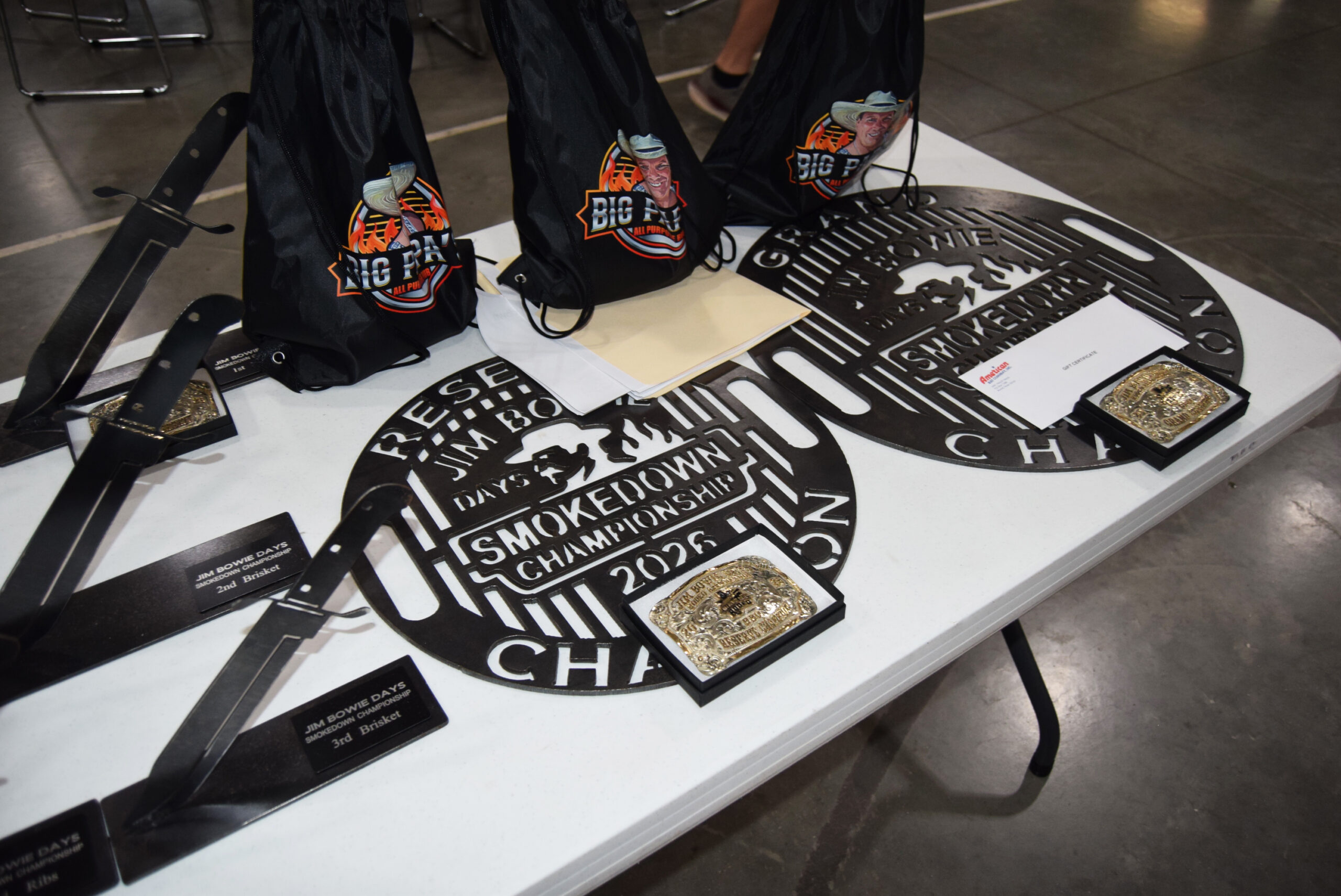
The 60th anniversary Jim Bowie Days Celebration opened on June 20th with a full day of activities focusing on sports and a barbecue cookoff.
Festivities continue throughout the week highlight by rodeo, youth rodeo, kid’s activities and Pioneer Court. The second annual Smokedown BBQ Cookout began on Friday night with the steak and beans contests. Three other categories for chicken ribs and brisket followed on Saturday. There were 27 teams, four more than last year.
Conducted by Outlaw BBQ, the grand champion was Vinny McNamara, with 36 points. Steve Cumbie was reserve grand champion with 26 points.
Read about all the weekend’s winners complete with many photos in your Thursday Bowie News.
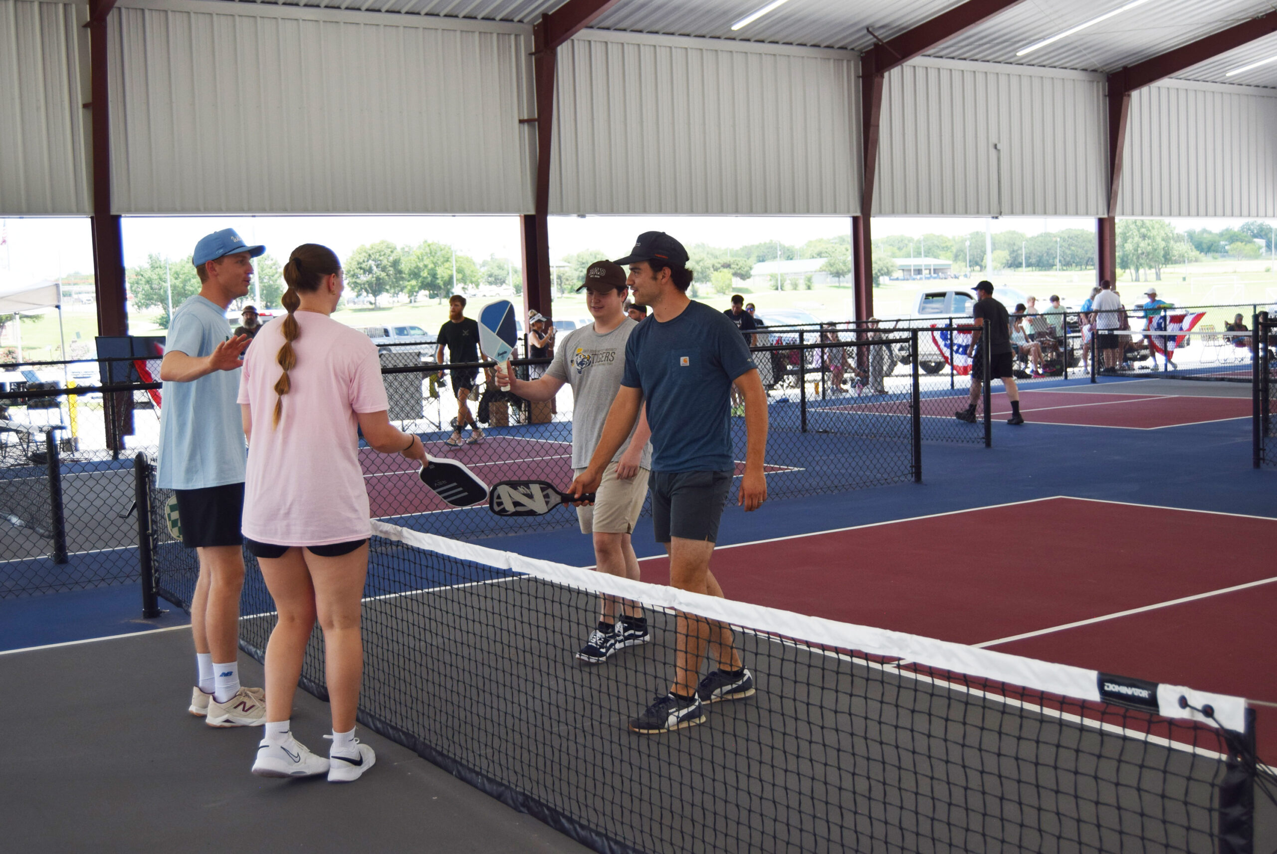
Top photo – The first annual pickleball tourney drew 17 teams. Teams greet each other before they start play (Photo by Barbara Green0


-

 NEWS3 years ago
Suspect indicted, jailed in Tia Hutson murder
-
 NEWS4 years ago
2 hurt, 1 jailed after shooting incident north of Nocona
-
 NEWS3 years ago
SO investigating possible murder/suicide
-
 NEWS3 years ago
Wreck takes the life of BHS teen, 16
-
 NEWS3 years ago
Murder unsolved – 1 year later Tia Hutson’s family angry, frustrated with no arrest
-
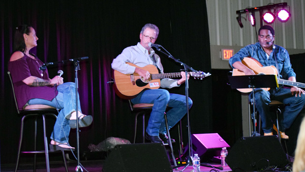 Show us something good9 years ago
Country music star children perform in Bowie
-
NEWS3 years ago
Sheriff’s office called out to infant’s death
-
 100th Birthday4 years ago
Looking back at the 1958 Centennial edition of The Bowie News