
NEWS
Heat dome to keep Central US sweltering throughout the week
By Alex Sosnowski, AccuWeather senior meteorologist
Published Jun. 20, 2022 12:21 PM CDT | Updated Jun. 21, 2022 2:16 PM CDT
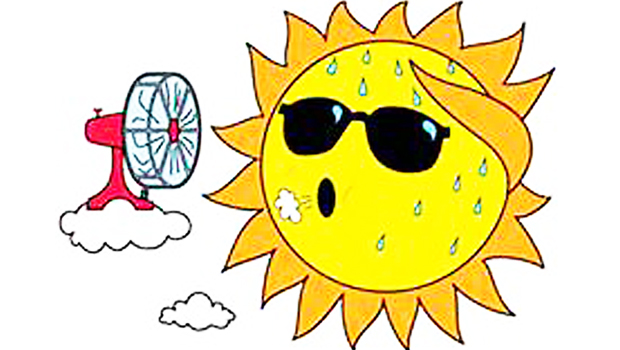
Extreme heat will continue across the central U.S., challenging daily records and creating a high risk of heat-related illnesses.
Forecasts indicate that dangerous and record-challenging heat is expected for the remainder of the week in the south-central United States, AccuWeather meteorologists say, while parts of the Midwest can expect temperatures to ease slightly from triple-digit highs at times.
A tremendous dome of heat will continue to spin over the central U.S. this week like a giant wheel with the most persistent extreme temperatures centered over the southern Plains and lower Mississippi Valley region.
Within the core of the heat dome, temperatures will peak well into the 90s to near 100 in many places, while AccuWeather RealFeel® Temperatures will reach the 110s at times. At this level, there is a high risk of heat-related illness, and people are encouraged to avoid strenuous activity, drink plenty of fluids and seek an air-conditioned environment when possible, experts say.
The buildup of heat can make many urban areas unbearable at night without air conditioning because paved, concrete and brick surfaces give off heat absorbed throughout the day for many hours at night.

As the giant wheel of heat wobbled, a surge of 100-degree warmth shifted from the Dakotas on Sunday to Minnesota and northern Wisconsin on Monday.
Bismarck, North Dakota, hit 100 Sunday and smashed the old record of 97 set during the Depression Era in 1933. Fargo, North Dakota, tied its record of 101 Sunday, which was also set in 1933.
Temperatures hit 101 in Minneapolis Monday, breaking the old record of 98 from 1933 and hitting triple digits for the first time since 2018. With extreme heat in the forecast, the Minnesota Department of Transportation took to social media in recent days to warn motorists about the possibility of roads buckling under the harsh conditions.
International Falls, Minnesota, a place with a reputation as the icebox of the nation, was hotter than Miami, located 1,700 miles to the southeast, on Sunday and Monday. The high on Sunday in International Falls was 93 degrees, compared to 92 in Miami. On Monday, highs in the two cities were 92 and 89 degrees respectively.
The second dangerous surge of heat in as many weeks will shift as the week progresses with the worst levels of both heat and humidity forecast for Tuesday into Wednesday in the Midwest, according to AccuWeather Senior Meteorologist Dean DeVore. This comes after much of the region had some relief from the extreme heat with high temperatures in the 80s and lower humidity over the past weekend.

This image shows actual temperatures (F) as of 2 p.m. CDT, Tuesday, June 21, 2022.
On Tuesday, the extreme heat, which could produce temperatures in the upper 90s and low 100s, will rotate southeastward into much of Wisconsin, Illinois, Michigan, Indiana, Iowa and Missouri. At Chicago’s O’Hare Airport, the record of 101 set during the blistering summer of 1988 will be challenged. That summer ranks as one of the hottest on record for much of the central U.S.
Tuesday’s record in Green Bay, Wisconsin, was also set in 1988 and will be challenged. It will be a similar story for St. Louis, where the record high of 99, also established in 1988, could be topped.
The excessive heat will continue to migrate southeastward at midweek. On Wednesday, temperatures in Nashville could rival the record high of 100 set in 1988. A bit farther to the east in Charlotte, North Carolina, the daily record of 100 Wednesday was set more recently in 2015. In Atlanta, the record high of 98 set in 1964 will be challenged.

As the bubble of extreme heat moves off to the southeast, temperatures will throttle back a bit with the aid of showers and thunderstorms in parts of the Midwest as the week progresses.
In Minneapolis, high temperatures will trend down to the upper 80s Tuesday and the mid-80s Wednesday. After Tuesday’s extreme heat, afternoon temperatures are forecast to hover in the mid-80s to near 90 in Chicago for the balance of the week.
Meanwhile, over much of the south-central region, little change in day-to-day temperature is anticipated through the weekend, which will keep the demand for energy high, forecasters say.
Many daily record highs over the South Central states will be just a bit out of reach in the pattern, with established records in most locations in the low 100s. However, high temperatures will still range from 5-15 degrees above average for the week.
Typical highs generally range from the low to middle 90s and will end up being within a few degrees of 100 each day in cities such as Dallas; Oklahoma City; Little Rock, Arkansas; and Shreveport, Louisiana.
The same bubble of intense heat is likely to rotate southwestward into the Mississippi Delta region toward the end of the week, and that could be enough to rival record highs. Even Gulf Coast cities such as New Orleans could record a 5- to 10-degree spike in high temperatures. The record highs of 101 set in 2009 and 97 set in 2016 could be challenged Friday and Saturday.

One-hundred-degree highs are forecast for Houston starting on Thursday and lasting through at least Sunday.
Another bubble of extreme may return to parts of the Plains and Midwest toward the end of the week.
“While temperatures and humidity levels ease a bit for the end of the week in parts of the Midwest, more dangerous temperatures and humidity will return by the upcoming weekend,” DeVore said.
Temperatures in St. Louis Saturday are forecast to rival if not break the record of 102 set in 1954. Similarly, temperatures could spike near the century mark in Nashville and make a run at the record of 100 set in 1988 on the same day.
A more substantial temperature decline may progress from late in the weekend to early next week over parts of the northern Plains and Upper Midwest, where highs may retreat to near average for a few days. However, no relief is in sight for much of the South Central states; most cool air and storms will be forced well to the west, north and east of the region.
For many portions of the northern and central Plains and Midwest so far this summer, there has been enough fluctuation in the heat to avoid long strings of days with record highs. The summers of 1953 and 1988 were brutal in this respect. There were many days in a row on which record highs were set and many of those temperature marks remain in the record books to this day.
For example, in downtown Kansas City, Missouri, the 11-day period from June 9 to June 19 saw seven record highs set in 1953. In 1988, record highs were broken every day from June 20 through 25 in Kansas City. Record highs set during the period from June 9 to June 25 range from 97 to 104 degrees in the city.

By BARBARA GREEN
editor@bowienewsonline.com
Bowie Independent School District Trustees hired a new high school principal Monday night and also learned about the small number of citizens who attended a series of three community forums.
Following a brief executive session moved up in the agenda the new high school principal Dean Johnson and his wife Katie, and children Whitley and Henley were introduced to the board. Johnson will come to Bowie from Farmersville where he has been the junior high principal since July 2019.
He replaces Joanne Keeler who resigned from the principal’s job last month.
Johnson received his bachelor degree from Midwestern State University in kinesiology and math followed by a master of education in education administration from Lamar University. He earned his doctorate of educational leadership from MSU in December 2024 and was named 2023 outstanding Doctoral Student from the West College of Education.
Public forums
Superintendent Donna Hale reported on a series of three community forums that were hosted across the district during the last few weeks. Only seven people attended the events, and Hale said while this was not the turnout they had hoped for, the small group had very good discussions on their specific concerns.
Read the full story in Thursday’s Bowie News.
Top photo – Dean Johnson with his wife Katie, and daughters, Whitley and Henley were introduced Monday night. (News photo by Barbara Green)

Members of the Nocona City Council discussed an array of topics from public nuisance issues to the sale of raw water to a local golf course.
Public nuisance issues such as old vehicles, dilapidated houses, weeds, rubbish, brush and related unsightly items were briefly discussed during the April 14 meeting. In recent months, citizens and council members have asked just what can be done to tackle these problems more effectively.
Read the full story in the Thursday Bowie News.
By BARBARA GREEN
editor@bowienewsonline.com
Members of the Bowie City Council approved phase one for 10 lots in a major new subdivision development next to the elementary school.
At the April 14 meeting, the replat for the Kingdom Ridge subdivision local off Upper Montague Road and Teglan Drive was up for discussion. Bill Calabretta, chairman of the planning and zoning commission, said that group gave its approval for the phase one replat.
Buck Ross of Kingdom Construction spoke to the council about his family’s plan for the subdivision which would have a total of 67 lots developed across four phases. Phase one has 10 lots in quarter-acre tracts.
“Our goal is to get more affordable housing maybe in the $200,000 range, but our plan may have to evolve in the future. This is the first major subdivision for new homes to be developed in many years,” said Ross.
Read the full story in the Thursday Bowie News.


-

 NEWS2 years ago
Suspect indicted, jailed in Tia Hutson murder
-
 NEWS3 years ago
2 hurt, 1 jailed after shooting incident north of Nocona
-
 NEWS3 years ago
SO investigating possible murder/suicide
-

 NEWS3 years ago
Wreck takes the life of BHS teen, 16
-

 NEWS3 years ago
Murder unsolved – 1 year later Tia Hutson’s family angry, frustrated with no arrest
-
 Show us something good9 years ago
Country music star children perform in Bowie
-
NEWS3 years ago
Sheriff’s office called out to infant’s death
-
 100th Birthday3 years ago
Looking back at the 1958 Centennial edition of The Bowie News