
COUNTY LIFE
Stormy weather expected Friday and Saturday in the south
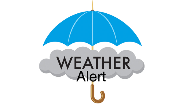
Americans across the southern United States are next in line for the threat of another outbreak of damaging storms heading into the weekend. AccuWeather meteorologists warn that people living in states from Texas to Georgia could be at risk for severe weather from late Friday night through Saturday night as a storm system progresses eastward.
Seven preliminary tornadoes were reported with the storms that erupted on Wednesday and Wednesday night, four of which occurred in Louisiana and caused damage to homes, according to the National Weather Service Storm Prediction Center (SPC). Dozens of incidents of damaging wind gusts, along with a few incidents of hail, stretched from eastern Texas northward to southern Wisconsin.
On the southwestern side of Cedar Rapids, Iowa, a tornado caused damage to homes and at least one injury. According to the NWS, the tornado was given a preliminary rating of EF0 and had wind speeds as high as 85 mph.
An EF0 tornado with maximum winds of 75 mph touched down briefly in Hancock County, Mississippi, moving northeastward and creating a .7 mile-long path with a width of 50 yards.
Remnants of the storms from Wednesday night pushed through the Interstate 10 and 20 corridors of Louisiana, Mississippi, Alabama, and the Florida Panhandle on Thursday morning.
As storms rolled through the New Orleans area early Thursday, a tornado warning was issued due to some indication of rotation on radar. While no tornado was confirmed, storms dumped between 2.40 and 2.70 inches of rain on the Big Easy in four hours.

By Thursday night, storms with big hail erupted over portions of central and eastern Texas, causing significant damage to vehicles. Hail as large as baseballs was reported in College Station.
Many of these same areas will be in the crosshairs of a new round of severe weather for the end of the week.

Areas extending from the southern Appalachians to the central Gulf coast are at risk for severe weather, according to AccuWeather Senior Storm Warning Meteorologist Eddie Walker.
The main threats from these storms in addition to flooding downpours are likely to be damaging wind gusts and hail.
The storms are expected to erupt near the edge of a zone of very warm air that could lead to some daily record highs being challenged in Texas on Friday. Temperatures are projected to climb into the 80s and 90s F over a broad area of Texas. A few locations, such as San Antonio, may come within a few degrees of 100 F.
“There is the potential for a derecho event during Friday night from parts of northeastern Texas and eastern Oklahoma to portions of Louisiana and Arkansas,” AccuWeather Lead Storm-Warning Meteorologist William Clark said. Should a derecho unfold, its path may eventually take it through Mississippi and Alabama early Saturday morning.
A derecho is a swift-moving complex of thunderstorms that produces extensive wind damage over hundreds of miles.
“With a fresh influx of Gulf of Mexico moisture in the form of humid air, combined with wind energy at the middle layer of the atmosphere associated with the approaching disturbance, the ingredients are there for severe weather from late Friday through Saturday,” AccuWeather Senior On-Air Meteorologist Justin Povick said. https://playlist.megaphone.fm/?e=ADL4348958722
The coverage and intensity of severe weather may hinge on the amount of sunshine available.
“Part of the atmospheric environment on Friday and Saturday may be strewn with clouds that limit daytime heating in part of the area at risk for severe weather, but where the sun breaks out, tall storms can erupt and pack a punch,” AccuWeather Chief On-Air Meteorologist Bernie Rayno said.

Take time to remember all those who gave all for our freedoms in America. The Bowie News staff wishes you a safe and happy holiday day weekend this Memorial Day. The News office will be closed on Monday for the holiday.

AUSTIN – With Memorial Day weekend marking the unofficial start to summer boating season, Texas Game Wardens are preparing for one of the busiest boating weekends of the year and reminding Texans and visitors alike to put safety first before heading out on the water.
In 2025, Texas recorded 178 reportable boating incidents that resulted in 50 fatalities and 77 serious injuries. Eighty-four percent of those who died in boating incidents were not wearing a life jacket. Texas Game Wardens also made 223 Boating While Intoxicated (BWI) arrests last year.
“Memorial Day weekend is when many families get back on the water for the first time this year,” said Col. Ron VanderRoest, director of Law Enforcement for the Texas Parks and Wildlife Department. “Before you leave the dock, take a few minutes to make sure your life jackets are on board, your boat is properly equipped and you have designated a sober operator.”
Texas Game Wardens encourage boaters to keep the following in mind before launching:
- Wear a U.S. Coast Guard-approved life jacket. Children younger than 13 are required to wear one while underway.
- Never operate a boat under the influence of alcohol or drugs.
- The operator must wear the lanyard or have the engine cut-off switch fob on their person when operating a boat equipped with one.
- Operate at a safe speed and maintain a proper lookout.
- Take a boater education course. It is required for anyone born on or after Sept. 1, 1993.
- Check the weather before heading out and be prepared for changing conditions.
- Leave a float plan with someone you trust.
- Don’t overload your boat.
“Boating should be fun,” said VanderRoest. “A little planning and some common sense help keep it that way.”
Renting a Boat or Personal Watercraft
If you plan to rent a boat or personal watercraft, choose a licensed vessel livery (a business establishment engaged in renting or hiring out vessels for profit).
By law, vessel liveries must provide all required safety equipment, explain how to operate the vessel, review applicable boating laws and have the operator sign a form acknowledging they received this information. They are also required to carry liability insurance.
Before leaving the dock, renters should make sure the vessel has enough life jackets for everyone on board and that they understand basic operating rules, including those specific to personal watercraft.
Personal Watercraft Safety
Personal watercraft, including jet skis, are subject to special laws in Texas. Operators and passengers must always wear a life jacket, the operator must use the engine cut-off switch, and these vessels may not be operated between sunset and sunrise. Operators must also stay at least 50 feet from other vessels, people and the shore unless traveling at headway speed.
“Whether you’re launching your own boat or renting one for the day, take the time to understand the rules and make safety part of your plan,” said VanderRoest. “If you take safety seriously from the start, you’re far less likely to need help later.”
For more information about boating laws, required equipment and boater education courses, visit the TPWD Boater Education Program at tpwd.texas.gov/boatereducation.

Starting at noon on May 25 at The V (VFW) in Nocona there will be a program for the Memorial Day featuring speakers, cannons and a rifle team.
There will be a Memorial Day Celebration Dinner at 5 p.m. on May 25 at the Nocona Senior Citizens Center (Carpenter Shop).
Call for reservations at 940-825-3148. The meal will include barbecue ribs, french fries, beans, cole slaw, dessert and ice team. Adults are $10 and children $5.
Proceeds benefit the senior center and the Meals on Wheels program at Nocona.


-

 NEWS3 years ago
Suspect indicted, jailed in Tia Hutson murder
-
 NEWS4 years ago
2 hurt, 1 jailed after shooting incident north of Nocona
-
 NEWS3 years ago
SO investigating possible murder/suicide
-
 NEWS3 years ago
Wreck takes the life of BHS teen, 16
-

 NEWS3 years ago
Murder unsolved – 1 year later Tia Hutson’s family angry, frustrated with no arrest
-
 Show us something good9 years ago
Country music star children perform in Bowie
-
NEWS3 years ago
Sheriff’s office called out to infant’s death
-
 100th Birthday4 years ago
Looking back at the 1958 Centennial edition of The Bowie News