
NEWS
March record month for tornadoes across the southern states

By Adriana Navarro,
AccuWeather staff writer
The month of March across the contiguous United States ended as it began: stormy. As the seasons clashed and spring fought to overtake winter, the tumultuous pattern sparked numerous severe weather events across the nation. When the final tally is in, March 2022 very well could set a record for the most tornadoes ever in the month of March across the U.S. since record-keeping began.
AccuWeather forecasters say global warming could be one factor behind the exceptional number of tornadoes in March.
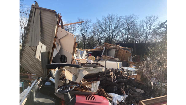
Montague County was the site of three separate EF-1 tornadoes on March 21 which caused major damage across the area.
At least 253 preliminary tornado reports were recorded throughout March 2022, according to the latest count from the Storm Prediction Center. While the number is preliminary, only 193 of the reports need to be confirmed as actual tornadoes to break the record of 192 confirmed tornadoes in 2017, according to the National Climatic Data Center. Records date back to 1950, though the numbers for 2020 through 2022 are preliminary.
The devastating storms that charged through the Midwest on the weekend of March 5, claiming the lives of at least seven people, served as a precursor to what the rest of the month would look like. It was during this storm that an EF4 tornado spawned, tearing through Winterset, Iowa, and killing six people, including four members of one family. This was also the storm during which the National Weather Service experienced a dissemination delay with their products, impacting the delivery time of tornado warnings.
While an NWS spokesperson said the service was still able to get the warnings out ahead of each tornado and had communicated the warning roughly 20 minutes before the tornado tore through Winterset, the technical difficulty was noted by U.S. lawmakers who days later introduced the TORNADO act.
Severe weather continued to spawn tornadoes, damaging wind gusts and hail throughout the month as the jet stream dipped into the south-central U.S., pulling moisture from the Gulf Coast northward, according to AccuWeather Chief Broadcast Meteorologist Bernie Rayno.
Cold intrusions from the north and desert air coming in from the west over the South Central states met abundant Gulf moisture, sparking the severe weather that residents in the area witnessed during March.
While many of the storms spawned a tornado or two throughout the month, the next outbreak sizeable in comparison to that at the beginning of the month didn’t come until March 21 to March 22 when severe weather charged through Texas and continued eastward.
This round of severe weather may bring to mind the video of a red truck tossed about in a tornado, accounts of two heavily damaged schools with no fatalities and the image of a huge tornado looming over New Orleans.
The storm claimed at least five lives, including that of a 73-year-old woman in the Grayson County community of Sherwood Shores in North Texas, a 25-year-old man in the New Orleans suburb of Arabi and three motorists in Holt, Alabama, who were found in their car, submerged in floodwaters.
For most of March, the contiguous U.S. didn’t go more than three days without a report of a tornado touching down, according to the Storm Prediction Center. Then, following March 23, there were five relatively calm days — the longest the month had gone without having a tornado report.
As the old adage in the weather business goes, though, the storm was not far behind.
A second round of severe weather soon struck not just the South but also the Midwest and Northeast the following week from March 29 to March 31, with at least 55 tornadoes confirmed across 13 states.
Unusually warm water in the Gulf of Mexico may have had a role in these previous two outbreaks, according to AccuWeather Chief Meteorologist Jonathan Porter.
“AccuWeather meteorologists noted unusually warm water off the Louisiana coast prior to the tornado outbreak on March 22, which included multiple tornadoes that struck the New Orleans areas,” Porter said.
AccuWeather meteorologists have been monitoring higher-than-normal water temperatures in the Gulf of Mexico over the last several years, especially for their relevance in the rapid intensification of hurricanes, including Laura and Ida, he added.
This warm water may have also played a role in providing additional low-level moisture, increasing the likelihood of tornadoes during the two severe weather events at the tail-end of the month as the company’s meteorologists have previously indicated may have contributed to the historic tornado outbreaks of December 2021 across the Central and Southern states.
While the waters off the Louisiana coast cooled slightly following the storms of March 22, warm water still existed farther east off the coast of Mississippi and Alabama and continued to warm prior to the outbreak on March 30, Porter said.
Increasing low-level winds in the atmosphere added another factor into the mix on March 30 when they transported this moisture-laden farther north into Mississippi and Alabama.
“Deep low-level moisture is one of the ingredients needed to produce tornadoes, and given our analysis of the rich low-level moisture — which was more than computer forecast models had predicted — [that was] present, we communicated the even greater tornado risk expected over Alabama and Mississippi during the evening on March 30 as low-level moisture increased as well as other atmospheric parameters becoming more favorable for tornadoes,” Porter said. “We suspect this unusually warm water was one of the key reasons there were more tornadoes further south and east, as far east as the Florida Panhandle during the March 30 outbreak when compared to March 22.”
Of the 72 filtered preliminary tornado reports from the Storm Prediction Center for that day, at least 28 had been reported in Mississippi and 21 in Alabama. The rest of the reports were scattered across Louisiana, Florida, Arkansas, Texas, Tennessee and even reached as far north as Indiana.
While there are other contributors to the higher-than-normal water temperatures in the Gulf of Mexico, Porter said that global warming remains a significant factor as the oceans are a heat sink — or a place the earth system stores excessive heat.
“A warming atmosphere is increasing, resulting in warming oceans all around the world, including the Gulf of Mexico,” Porter said. “While this has wide-ranging implications, one impact has already been seen – in the right conditions, warmer waters can contribute to increasing the risk for tornadoes well away from the ocean.”

Members of the Bowie City Council will meet at 6 p.m. on Aug. 25 to finalize the budget and conduct a public hearing on a proposed tax rate.
The ordinances adopting both the 2026-27 budget and the 2026 tax rate are on the agenda for action. The public hearing on the tax rate presents a rate of .5750 cents per $100 in property value, which is slightly higher than the 2025 rate that is .5430.
The new rate is projected to generate $2,990,998, compared to $2,703,176 from last year’s rate. This is the first significant change in the rate since 2019, when it was .5445 cents. The next year it went to .5447 cents, where it stayed until 2023, when it went to .5430 cents, through 2025.
A bid will be awarded for the Rock and Pillar Street drainage project. Wall Contractors will be recommended by the city engineer and staff review. The bid came in about $1.3 million, which was lower than the estimated $2 million. It is expected to straighten the channel and get this intersection reopened for traffic after more than a year of closure to collapse of a portion of the pavement on the street.
The council will consider stop signs regulating traffic flow around the Kingdom Ridge Subdivision next to the elementary school.
In the city manager’s report Bert Cunningham will provide information on the hazard mitigation plan, the 2025-26 audit preparation and the bid for the Rock and Pillar project.

Montague County Commissioners will adopt a budget and tax rate when they meet at on Aug. 24 in the courthouse annex.
The budget hearing will be at 8:30 a.m. Aug. 24, followed by a public hearing for the proposed tax rate at 8:45 a.m.
During the regular meeting at 9 a.m., there will be one final budget workshop for any last minute tweaks or changes, followed by adoption of the 2026-27 budget and 2026 tax rate.
The proposed tax rate is .4961 cents per $100 in property value, which is the same rate as 2025. Due to the increase in property values despite the same rate, the total tax levy on all properties will see a 3.64% increase.
A copy of the proposed budget is available on the county website at https://www.co.montague.tx.us/.
Several other financial related items are on the agenda. Accumulated comp time in the sheriff office and jail will be discussed. The commissioners also will consider any year-end expenditures utilizing any or the budget year contingency funds.
Other items on the agenda will include: Acceptance of the District Attorney’s 2023- 2024 and 2025 Chapter 59 asset forfeiture reports and authorize DA Katie Boggeman to sign them; imposition of optional fees from the Texas Department of Motor Vehicles for 2027; House Bill 3834 cybersecurity and AI training certification for state and local governments compliance reports; interlocal cooperation agreement between the Department of Public Safety and the county court and district court; review the sherif office application for sheriff immigration law enforcement grant program Senate Bill 8; consider distribution of state grant HB 3000; and consider using Real Estate Station LLC Agent Denise Thurman to sell 5.9 acres on the corner of U.S. 81 and State Highway 59.
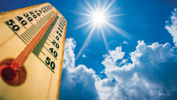
It should be no surprise, the month of July is recorded as the hottest month on record for the country.
July wrapped up with seven straight days of 100 degrees or higher July 25-31. August also opened hot with the first 100-plus degree day on Aug. 3 and it has topped that marked through Aug. 19. On Tuesday the high was 107 degrees at the water plant, but in town thermometers recorded 108 and 109 degrees.It was expected to top that mark on Wednesday.
There was no rainfall recorded in July or in August. Bowie has only 21.71 inches for the year so far and Nocona has 22.35 inches.
Lake Amon Carter
Aug. 19 –
917.22 msl, 80.2% full
July 19 – 918.10 msl, 86.1%
Aug. 19, 2025 – 919.84 msl, 98.8% full
Lake is full at 920msl
Lake Nocona
Aug. 19 – 823.48 msl, 76.3% full
July 19 – 824.41 msl, 81.05%
Aug. 19, 2025 – 826.878 msl, 95.85%
Lake full at 827.5msl






-

 NEWS3 years ago
Suspect indicted, jailed in Tia Hutson murder
-
 NEWS4 years ago
2 hurt, 1 jailed after shooting incident north of Nocona
-
 NEWS3 years ago
SO investigating possible murder/suicide
-

 NEWS4 years ago
Wreck takes the life of BHS teen, 16
-

 NEWS3 years ago
Murder unsolved – 1 year later Tia Hutson’s family angry, frustrated with no arrest
-
 Show us something good9 years ago
Country music star children perform in Bowie
-
 100th Birthday4 years ago
Looking back at the 1958 Centennial edition of The Bowie News
-
NEWS3 years ago
Sheriff’s office called out to infant’s death