
NEWS
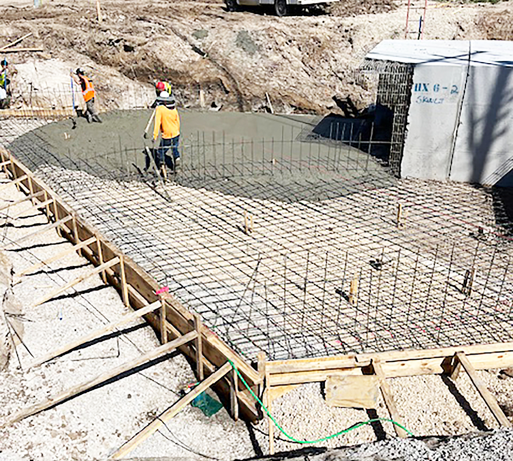
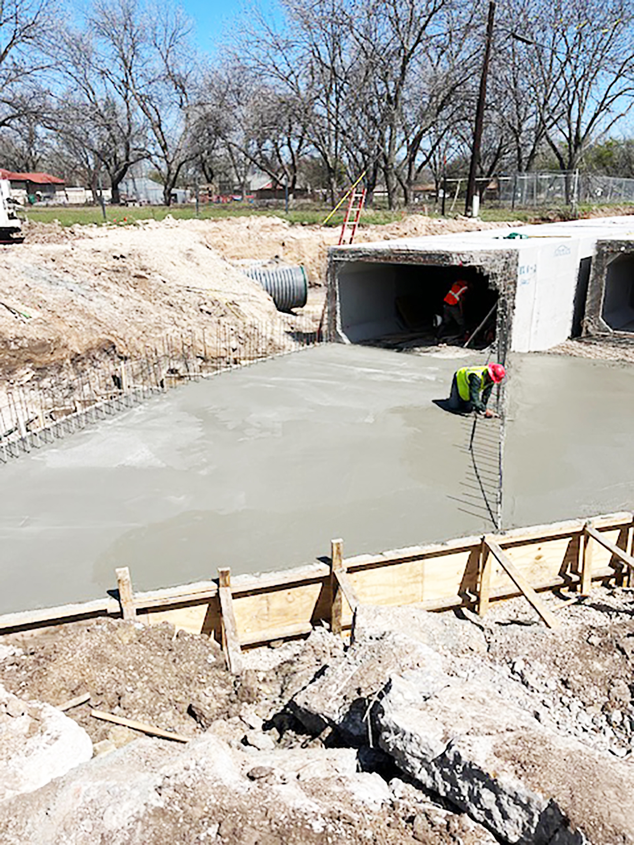
Concrete work changes face of Nelson Street drainage project
By BARBARA GREEN
editor@bowienewsonline.com
Montague County Commissioner’s Court reluctantly returned money to the state connected to Senate Bill 22 in fiscal 2024.
During Monday’s regular session, County Auditor Charley Lanier explained the three transactions. SB 22 provided funding for prosecutor offices to assist with paying staff, and in the sheriff’s office for staff and equipment.
If all the money was not spent it had to be returned. Lanier explained the fund was approved in 2024, but it arrived after the fiscal year began and commissioners did not want to spend any of until the funds actually arrived in county coffers.
Read the full story in the Thursday Bowie News.

The Saint Jo City Council had a brief meeting on June 17.
The 2026-27 budgets for appraisal and tax collections from the Montague County Tax Appraisal District were approved. The tax collection budget faces a 3.71% increase and 2.2% in the appraisal budget.
The city’s payment for tax collections will go from $1,305 for the year down slightly from $1,445 last year. The appraisal portion for Saint Jo will be $9,526, up from $9,361 in 2026.
A municipal election for Nov. 3 was called. Places open on the ballot will be mayor, and the places filled by Melissa McPherson and Jack Dunn, who was appointed to fill out a term.
The council approved a resolution to apply for grants for water infra structure improvements through the Texas Water Development Board. The city is working with engineers from Corlett, Probst and Boyd of Wichita Falls on a proposed project.
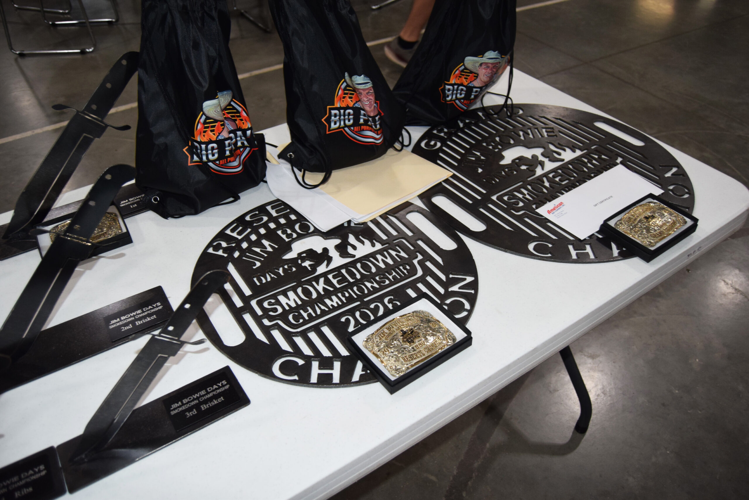
The 60th anniversary Jim Bowie Days Celebration opened on June 20th with a full day of activities focusing on sports and a barbecue cookoff.
Festivities continue throughout the week highlight by rodeo, youth rodeo, kid’s activities and Pioneer Court. The second annual Smokedown BBQ Cookout began on Friday night with the steak and beans contests. Three other categories for chicken ribs and brisket followed on Saturday. There were 27 teams, four more than last year.
Conducted by Outlaw BBQ, the grand champion was Vinny McNamara, with 36 points. Steve Cumbie was reserve grand champion with 26 points.
Read about all the weekend’s winners complete with many photos in your Thursday Bowie News.
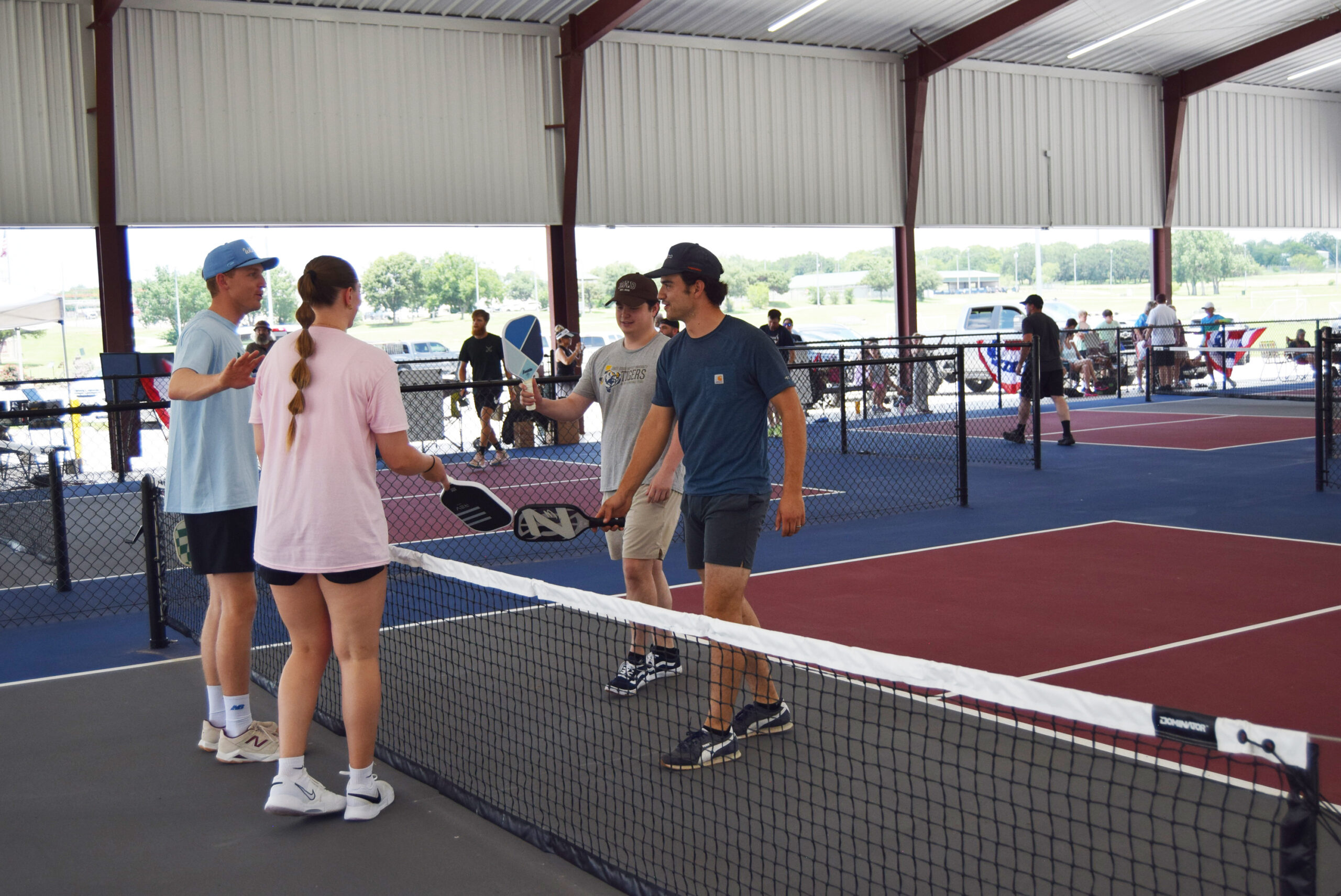
Top photo – The first annual pickleball tourney drew 17 teams. Teams greet each other before they start play (Photo by Barbara Green0


-

 NEWS3 years ago
Suspect indicted, jailed in Tia Hutson murder
-
 NEWS4 years ago
2 hurt, 1 jailed after shooting incident north of Nocona
-
 NEWS3 years ago
SO investigating possible murder/suicide
-
 NEWS3 years ago
Wreck takes the life of BHS teen, 16
-

 NEWS3 years ago
Murder unsolved – 1 year later Tia Hutson’s family angry, frustrated with no arrest
-
 Show us something good9 years ago
Country music star children perform in Bowie
-
NEWS3 years ago
Sheriff’s office called out to infant’s death
-
 100th Birthday4 years ago
Looking back at the 1958 Centennial edition of The Bowie News