NEWS
Nocona looking at selling subdivision lots
The annual financial report for 2022-23 will be placed on a future agenda of the Nocona City Council after the outside auditor was ill and unable to make the presentation.
City Secretary Revell Hardison said she anticipated it would be on the April meeting.
City Manager Lynn Henley sought direction from the council on 14 lots of city parkland that were never sold back in 2001 and 2002. These lots are located south of the hospital and east of the golf course. They are part of city parkland that created the golf course. Some of the lots were sold and developed with houses near the hospital in Indians Oaks phase one, but these lots in question were never sold.
Mayor Robert Fenoglio said with a shortage of new homes in the city, it may be good to see if there is some interest and the city could possibly put them up for sale.
Read the full story in the weekend Bowie News.
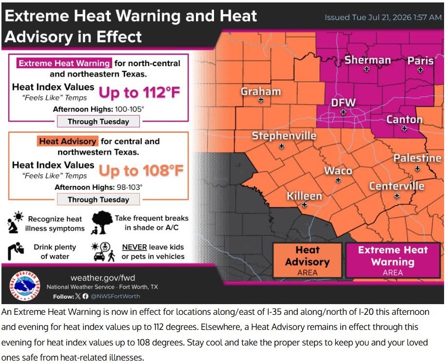
NEWS
Early voting for May 2 Nocona General board election ends April 28
Early voting for the Nocona General Hospital District Board of Directors saw 285 voters cast their ballot during the first week of early voting.
Ballots may be cast early through April 28. Election day is May 2, 7 a.m. to 7 p.m. All voting is in the Nocona City County room at 102 Clay Street.
Candidates include two incumbents, Charles May and Ron Brown. De Brown, who had filed for re-election, later withdrew. Steve Bates and Shawn Patton are the other candidates. Three seats are open on the board.
NEWS
Weather update
TORNADO WARNING FOR SOUTH WESTERN MONTAGUE COUNTY HAS BEEN CANCELED. HOWEVER, A SEVERE THUNDERSTORM WARNING (BELOW) HAS BEEN ISSUED.
BULLETIN – EAS ACTIVATION REQUESTED
Severe Thunderstorm Warning
National Weather Service Fort Worth TX
733 PM CDT Sat Apr 25 2026
The National Weather Service in Fort Worth has issued a
* Severe Thunderstorm Warning for…
Southwestern Montague County in north central Texas…
Northwestern Wise County in north central Texas…
Northeastern Jack County in north central Texas…
* Until 830 PM CDT.
* At 731 PM CDT, a severe thunderstorm was located near Newport, or
16 miles southwest of Bowie, moving southeast at 20 mph.
HAZARD…Tennis ball size hail and 70 mph wind gusts.
SOURCE…Trained weather spotters. At 729 PM CDT, 70 mph winds was
reported by Jacksboro Fire at Highway 148 and the Jack-
Clay County line.
IMPACT…People and animals outdoors will be injured. Expect hail
damage to roofs, siding, windows, and vehicles. Expect
considerable tree damage. Wind damage is also likely to
mobile homes, roofs, and outbuildings.
* This severe thunderstorm will be near…
Newport around 735 PM CDT.
Lake Bridgeport around 810 PM CDT.
Chico around 820 PM CDT.
Other locations impacted by this severe thunderstorm include Wizard
Wells, Cundiff, Park Springs, Postoak, Crafton, Fruitland, and
Vineyard.
PRECAUTIONARY/PREPAREDNESS ACTIONS…
A Tornado Watch remains in effect until 1100 PM CDT for north central
Texas.
For your protection get inside a sturdy structure and stay away from
windows.
Continuous cloud to ground lightning is occurring with this storm.
Move indoors immediately. Lightning can kill.
THUNDERSTORM DAMAGE THREAT…CONSIDERABLE
HAIL THREAT…RADAR INDICATED
MAX HAIL SIZE…2.50 IN
WIND THREAT…OBSERVED
MAX WIND GUST…70 MPH
NEWS
Tornado warning issues for southwestern Montague County
Tornado Warning
National Weather Service Fort Worth TX
709 PM CDT Sat Apr 25 2026
The National Weather Service in Fort Worth has issued a
* Tornado Warning for…
Southwestern Montague County in north central Texas…
Northeastern Jack County in north central Texas…
* Until 800 PM CDT.
* At 708 PM CDT, a severe thunderstorm capable of producing a tornado
was located 10 miles east of Windthorst, or 21 miles south of
Henrietta, moving southeast at 20 mph.
HAZARD…Tornado and tennis ball size hail.
SOURCE…Radar indicated rotation.
IMPACT…Flying debris will be dangerous to those caught without
shelter. Mobile homes will be damaged or destroyed.
Damage to roofs, windows, and vehicles will occur. Tree
damage is likely.
* This tornadic thunderstorm will remain over mainly rural areas of
southwestern Montague and northeastern Jack Counties, including the
following locations… Postoak.
PRECAUTIONARY/PREPAREDNESS ACTIONS…
TAKE COVER NOW! Move to an interior room on the lowest floor of a
sturdy building. Avoid windows. If you are outdoors, in a mobile
home, or in a vehicle, move to the closest substantial shelter and
protect yourself from flying debris.
TORNADO…RADAR INDICATED
MAX HAIL SIZE…2.50 IN
-
NEWS2 years agoSuspect indicted, jailed in Tia Hutson murder
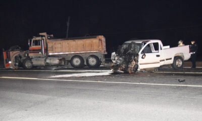
-
NEWS3 years ago2 hurt, 1 jailed after shooting incident north of Nocona
-
NEWS3 years agoSO investigating possible murder/suicide
-
NEWS3 years agoWreck takes the life of BHS teen, 16
-
NEWS3 years agoMurder unsolved – 1 year later Tia Hutson’s family angry, frustrated with no arrest
-
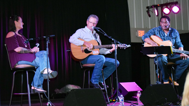
Show us something good9 years agoCountry music star children perform in Bowie
-
NEWS3 years agoSheriff’s office called out to infant’s death
-
100th Birthday3 years agoLooking back at the 1958 Centennial edition of The Bowie News


